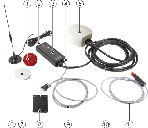
About the GPS receiver
The GPS receiver can be used worldwide. In Europe and North America, it works with the GPS system and the WAAS and EGNOS correction systems. In locations where WAAS and EGNOS cannot be used, the GPS receiver can use the GPS system together with GLONASS satellites. The correction signal is then calculated internally (using GLIDE technology).
The GPS receiver can also function with other correction signals. In order to do this, the GPS receiver must be connected with a GPS modem or an RTK radio modem.
GLONASS
GLONASS is a Russian satellite system which can be used in addition to the American GPS system.
WAAS and EGNOS
WAAS and EGNOS are satellite-based correction services which can be used in Europe and North America.
GLIDE
GLIDE technology can be used in parallel to other methods. This thus increases path-to-path accuracy.
RTK
Systems which work with RTK consist of a fixed base station and a mobile receiver. The base station transmits correction signals to the mobile receiver by means of a modem. This enables levels of accuracy in the centimeter range.
Accuracies
The accuracy of the GPS receiver is dependent on the site in which you are located.
Accuracy is also described using the following values:
- ▪
- Path-to-path accuracy describes the maximum displacement of the GPS position during field work. A path-to-path accuracy of 2.5 cm means that the overlap or defect during parallel movements is a maximum of 2.5 cm.
- ▪
- Absolute accuracy is the accuracy with which a movement can be repeated after days, months or years. An absolute accuracy of 2.5 cm means that the deviation of a movement after one year is a maximum of 2.5 cm. This maximum deviation also applies if, after one year has passed, you use the field limits, guidance lines, obstacles, etc. in the TRACK-Leader application from the previous year.


