Setting a reference point
The coordinates of the GPS receiver are crucial when setting the reference point. If you do not want to dismantle the GPS receiver each time, you must always set the vehicle in the same position. This means that the GPS receiver is also in the same position.
When setting the reference point, you will require a fixed permanent point whose position will not alter over time. For example, this can be a tree, a landmark or a manhole cover.
This point is required in order to position the tractor in exactly the same position for future GPS signal calibrations.
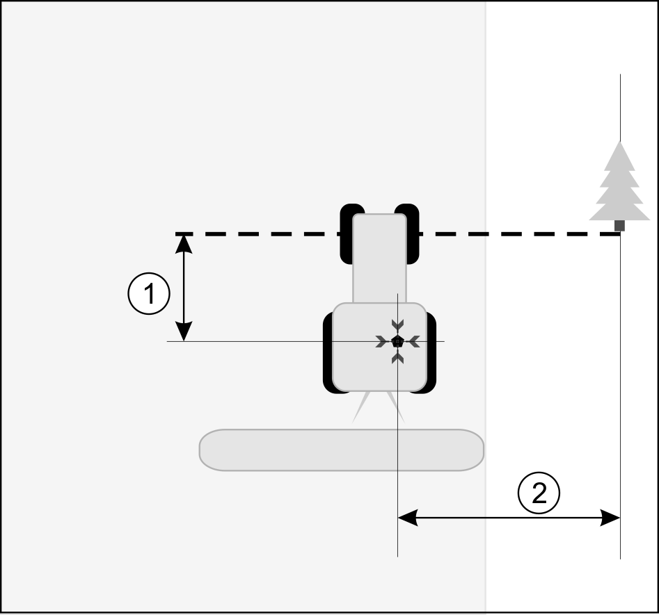
The illustration below shows a possible position of the tractor when setting the reference point:
Tractor when setting the reference point
Procedure
- þ
- You are processing a field for the first time.
- 1.
- Identify a fixed permanent point at the entrance to the field. For example, this can be a tree, a landmark or a manhole cover.
- 2.
- Draw a line from the fixed permanent point over the road.
- 3.
- Position the tractor such that both of its front wheels are on the line.
- 4.
- Note the distance between the point and the tractor.
This distance must always be the same for future GPS calibrations.
- 5.
- Start a new navigation.
- ⇨
- The program determines the current position over a period of 15 seconds, and saves this as the "Reference point". The reference point must be set precisely at the position of the GPS antenna.
- ⇨
- In doing so, any existing reference points and signal calibrations are deleted.
- ⇨
- You have now set the reference point.


 - Press
 - Press
 - Press